National Park of American Samoa HistoryThe National Park of American Samoa is located on three volcanic and mountainous islands and covered with tropical rain forest Rugged cliffs, glistening beaches, and coral reefs can be found at this national park. American Samoa is made up of seven islands with a total land area of 76 square miles. The chain of islands is located 2,300 miles southwest of Hawaii and over 4,100 miles southwest of San Francisco. It is one of the most remote national parks in the United States. It is also one of the newest; it was authorized by the U.S. Congress in 1988 and officially established in 1993 when a 50 year lease was signed. The National Park of American Samoa is the 50th chronological U.S. National Park. Congress authorized the park preserve and protect the tropical rain forest ecosystem, flying fox fruit bat habitat, the coral reefs, and the 3,000 year-old Samoan culture and archaeological resources. Although the park was authorized in 1998 by public law, the National Park Service could not buy land because of the traditional Samoan land system. On September 9, 1993 the NPS started a 50-year lease for the park land from the Samoan village councils. In 2002, Congress approved a thirty percent expansion on Olosega and Ofu islands.
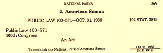
Picture of the act made to establish the National Park of American Samoa.
|
Quick Stats & Fun FactsLocation: American Samoa
Established: October 31, 1988 Size: 13,500 acres (9,500 land, 4,000 marine) Lowest Elevation: 0 feet at the South Pacific Ocean Highest Elevation: 3,056 feet at Olamatimu Home to over 900 species of fish and 35 species of tropical birds. Samoa means "sacred earth." 420 acres are located mostly under water American Samoa is the only United States territory south of the equator. |
Click on the links below to access other pages on the site.
